
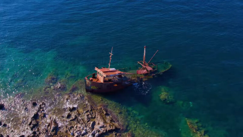
Somewhere beneath the waters off Cape Hatteras, North Carolina, lie the remains of sailing ships, merchant vessels, military warships, and German submarines. Some have been underwater for centuries. Others disappeared within living memory.
This stretch of the American coastline has earned a particularly grim nickname: the Graveyard of the Atlantic.
The U.S. Geological Survey estimates that more than 1,000 ships have been lost off Cape Hatteras since 1600. Estimates covering the wider Outer Banks run into the thousands.
Those numbers are staggering, especially considering how many generations of sailors knew about the dangers and continued navigating these waters.
I’ve always found that aspect of Cape Hatteras particularly unsettling. The danger was well documented, the consequences could be catastrophic, and ships still had compelling reasons to approach this coast.
To understand why, you have to look at what happens beneath the surface.
Diamond Shoals: The Underwater Trap That Sank Hundreds of Ships
Cape Hatteras sits along North Carolina’s Outer Banks, a chain of narrow barrier islands separating the Atlantic Ocean from the mainland.
Extending offshore is Diamond Shoals, an enormous system of submerged sandbars that has caused trouble for mariners for centuries.
These shallow sand formations stretch miles into the Atlantic. Their positions change as currents and storms move sediment across the seabed.
Imagine navigating a large sailing ship toward what appears to be open water, only to discover that the seabed rises dangerously close to your hull.
Worse, the hazards might have shifted since your charts were drawn.
A ship running aground could become trapped while powerful waves repeatedly struck its hull. Wooden vessels were especially vulnerable to breaking apart under that punishment.
According to the National Park Service’s shipwreck history, thousands of vessels historically traveled coastal trade routes that brought them around the Outer Banks and dangerously close to Diamond Shoals.
The geography made the area particularly cruel. Ships relied on coastal routes for commerce, and the shallow waters threatened the very vessels passing through them.
Two Powerful Ocean Currents Make Navigation Even Harder
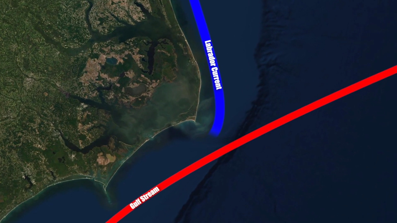
Cape Hatteras also occupies an unusual position in the Atlantic’s circulation system.
The warm Gulf Stream flows northward along the eastern United States, while colder water associated with the Labrador Current moves southward. Near Cape Hatteras, these current systems interact.
The resulting conditions can be especially difficult when strong winds oppose the direction of the water.
Waves become steep and confused, currents complicate navigation, and vessels can struggle to maintain their intended course.
For sailing ships dependent on wind and favorable currents, these conditions presented serious problems.
There was also a powerful economic incentive to navigate nearby. Favorable currents could shorten voyages, making the coastal passage attractive to merchants transporting goods between American ports and overseas markets.
That’s one of the most revealing details in this entire story. The same currents that helped make Cape Hatteras an important shipping corridor contributed to its extraordinary maritime losses.
Commercial necessity repeatedly brought sailors into dangerous waters.
Hurricanes, Nor’easters, and a Coastline That Keeps Moving
The Outer Banks have another serious problem: their exposure to Atlantic storms.
Hurricanes can drive enormous waves toward the coast, while winter nor’easters produce strong winds, dangerous surf, and prolonged periods of rough seas.
For historical sailors, a storm could quickly turn an already difficult passage into a disaster.
The islands themselves offered few prominent landmarks. In poor visibility, crews might realize they were approaching land only after entering dangerously shallow water.
The continually changing coastline added another complication. Even the seabed was an unreliable reference.
The famous black-and-white spiral Cape Hatteras Lighthouse, completed in 1870, helped mariners identify their position and avoid the shoals.
View this post on Instagram
It remains one of America’s most recognizable coastal structures.
Personally, I think its history deserves considerably more attention than its appearance. The lighthouse represents generations of attempts to make an economically essential shipping route safer.
There’s a similar relationship between engineering and severe Atlantic weather in the story of Norway’s Atlantic Road, where construction crews faced repeated powerful storms while connecting coastal communities.
The Shipwrecks That Made Cape Hatteras Famous
Among the countless vessels lost around Cape Hatteras, several have particularly remarkable histories.
USS Monitor: A Revolutionary Warship Lost to a Storm
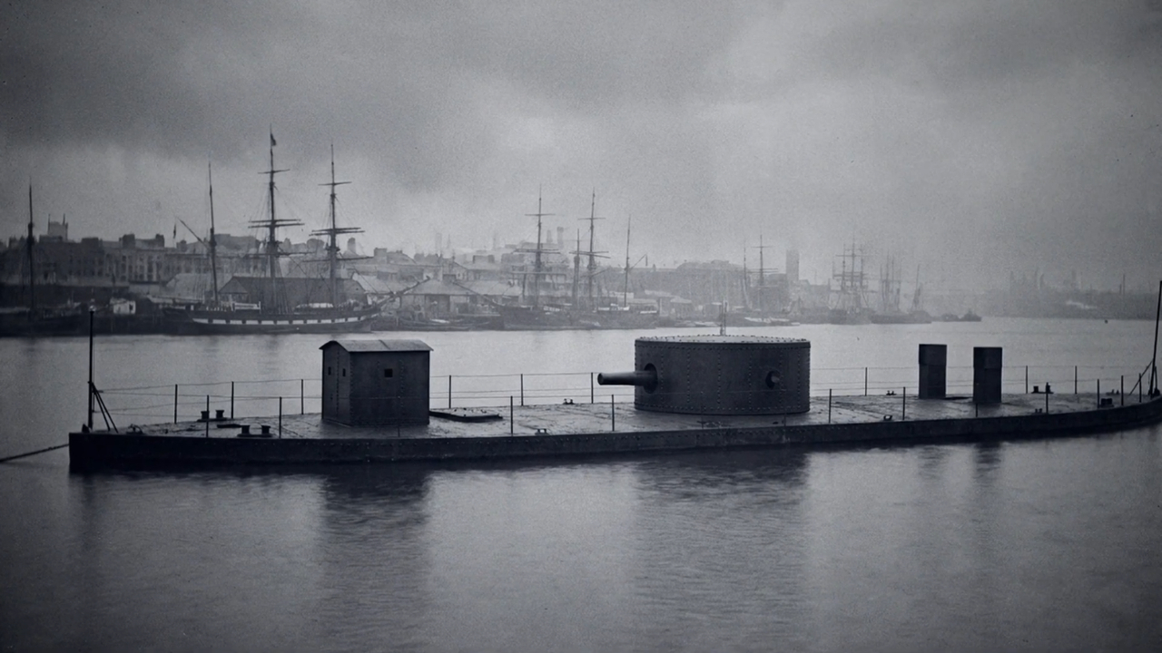
The USS Monitor was among the most important warships of the American Civil War.
Its innovative ironclad design and rotating gun turret helped transform naval warfare.
Yet on December 31, 1862, while being towed off Cape Hatteras, the vessel encountered a violent storm.
Water flooded the ship, its pumps struggled, and the Monitor eventually sank. Sixteen sailors died.
The wreck was discovered in 1973 and subsequently became the centerpiece of America’s first national marine sanctuary, designated in 1975.
The National Oceanic and Atmospheric Administration continues to study and preserve the site.
There’s something sobering about a revolutionary military vessel being destroyed by conditions that had threatened ordinary merchant ships for generations.
Carroll A. Deering: The Abandoned Ghost Ship
Another famous case involves the five-masted schooner Carroll A. Deering.
The “ghost ship” Carroll A. Deering was a five-masted schooner, 255 feet long, built in Maine in 1919. In early 1921, she was working her way north from South America under Captain Willis Wormell, a retired master in his sixties who had taken the ship over after her original captain fell ill.
The voyage was not a happy one. At Barbados, the first mate, Charles McLellan, drank heavily, complained that Wormell would not let him discipline the crew, and was arrested. Wormell bailed him out.
On January 29, 1921, the schooner passed the Cape Lookout Lightship. A man hailed the lightship through a megaphone to report that the ship had lost her anchors. The keeper later said the man did not look or speak like an officer, and that crewmen were standing about on the quarterdeck, where they had no business being.
Two days later the Deering was found hard aground on Diamond Shoals off Cape Hatteras with her sails set. Heavy seas kept boarding parties away until February 4. Food sat part-prepared in the galley. The lifeboats, the ship’s papers, the navigation instruments, and every man aboard were gone.
A federal investigation ran into 1922 and reached no conclusion. The crew was never found.
Eerie historical photos: https://t.co/0WklG7bVfh
— Fascinating (@fasc1nate) October 13, 2026
On January 31, 1921, the ship was discovered grounded on Diamond Shoals. Its crew had disappeared.
Investigators examined possibilities ranging from mutiny to piracy. None produced a definitive explanation.
The mysterious circumstances generated decades of speculation, including a supposed message in a bottle that investigators eventually exposed as a hoax.
The National Park Service documents the case and the unsuccessful investigation.
I find the genuine uncertainty compelling enough. The surviving evidence raises questions that deserve careful examination, and the invented stories have done little to clarify what happened.
World War II Added Another Deadly Chapter
Natural hazards account for much of Cape Hatteras’s reputation, but wartime attacks added another devastating layer.
During World War II, German submarines targeted commercial shipping along America’s Atlantic coast.
Cape Hatteras became a particularly dangerous area in 1942.
According to NOAA’s maritime heritage records, 90 vessels were lost off North Carolina between 1942 and 1945 as a result of the wartime conflict, including merchant vessels, Allied warships, and German submarines.
One particularly tragic example was the American oil tanker Dixie Arrow.
On March 26, 1942, the German submarine U-71 torpedoed the tanker near Diamond Shoals. The vessel caught fire and sank, killing 11 crew members.
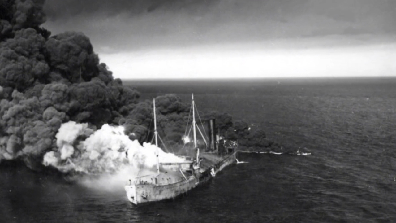
The wreck still rests offshore.
Other discoveries reveal just how close this warfare came to the American mainland. The German submarine U-576 and the freighter Bluefields, which it sank in July 1942, lie roughly 1,000 feet apart on the ocean floor.
I think this wartime history deserves far greater recognition. The Atlantic battlefields of World War II extended into waters used routinely by American commercial vessels, and many of the people who died were civilian merchant sailors.
The People Who Risked Their Lives Saving Strangers
The shipwreck history of Cape Hatteras also reveals something important about the communities living along the Outer Banks.
Local residents frequently helped survivors, sometimes entering dangerous surf to reach stranded vessels.
During the nineteenth century, organized lifesaving stations gradually developed along the coastline.
One extraordinary figure was Richard Etheridge, who commanded the all-Black crew of the Pea Island Life-Saving Station.
In October 1896, the schooner E.S. Newman grounded during a hurricane.
View this post on Instagram
With conventional rescue methods impossible, Etheridge directed his crew to use ropes and swim through dangerous surf to reach the vessel.
They rescued all nine people aboard.
The crew’s bravery was formally recognized with the Coast Guard’s Gold Life-Saving Medal in 1996, a century after the rescue.
The National Park Service’s account of Etheridge also documents the racial discrimination he encountered during his career.
His story is one of the most important in the Graveyard of the Atlantic’s history.
I would argue that any serious account of Cape Hatteras should give these rescuers as much attention as the wrecks themselves. Their courage deserves a permanent place in the region’s historical identity.
Can You Still See Shipwrecks at Cape Hatteras?
Some remnants remain visible along the Outer Banks, although many wrecks are buried beneath shifting sand or submerged offshore.
Storms occasionally expose wooden timbers and other remains on the beaches before the sand covers them again.
Visitors interested in this history can explore the Graveyard of the Atlantic Museum in Hatteras, which preserves and interprets the region’s maritime heritage.
The museum’s official website provides information about its collections and visiting arrangements.
The surviving wrecks are historical sites, and any exposed remains should be left undisturbed.
Why the Graveyard of the Atlantic Still Matters
@theouterbanksncJoin Caleb as he sees how the newly opened Graveyard of the Atlantic runs with the help of volunteers!♬ original sound – The Outer Banks
Cape Hatteras earned its reputation through an extraordinary combination of dangerous geography, powerful currents, violent storms, heavy maritime traffic, and warfare.
Centuries of shipwrecks have left an archaeological record of changing ships, navigation methods, commerce, and human survival.
For me, the most compelling part of this history is how closely everything connects: the merchants who accepted the risks, the sailors who struggled against the weather, the communities that depended on shipping, and the rescuers who went into the surf after them.
Every wreck represents a particular voyage, a set of decisions, and people whose lives were changed by what happened offshore.
That’s what gives the Graveyard of the Atlantic its historical weight. Beneath those waters lies an enormous part of America’s maritime past, preserved in the remains of ships that never completed their journeys.