
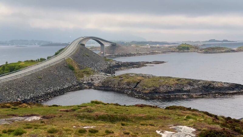
There’s a bridge on Norway’s Atlantic Road that looks as though its builders ran out of road halfway across the water.
Approach it from a particular angle, and the asphalt climbs sharply, curves to one side, and disappears. Beyond the highest point, there’s apparently nothing except the Norwegian Sea.
The photographs make it look like a road designed by someone who had never considered what happens when a car reaches the end.
Fortunately, Storseisundet Bridge isn’t nearly as frightening as it looks. The 260-meter structure is perfectly continuous. Its strange appearance comes from the combination of a rising arch, a horizontal curve, and an unusually effective optical illusion.
What’s very interesting to me is that Norway didn’t build it to impress tourists. The bridge belongs to a coastal road that solved a genuine transportation problem. Its international fame came later.
Why Storseisundet Bridge Looks Like It Ends in Midair
Storseisundet Bridge, known locally as Storseisundbrua, crosses a narrow stretch of water between rocky islands in Møre og Romsdal, western Norway.
Unlike a conventional straight bridge, it bends as it rises. From certain viewpoints, the far side of the roadway becomes hidden behind the crest. The guardrails seem to end abruptly, leaving the impression that the road drops directly into the sea.
It’s a clever trick of perspective, although there’s nothing intentionally deceptive about the engineering.
The road continues safely around the curve and descends toward the opposite shore. Seen from another angle, the bridge looks considerably less alarming.
I find that contrast particularly interesting. Most famous bridges impress us through sheer size, enormous towers, or record-breaking spans. Storseisundet is comparatively modest. Its reputation depends on where you’re standing when you look at it.
The bridge has become a photographic attraction because of what the camera conceals, rather than everything the structure reveals. And that makes it worth seeing from more than one viewpoint.
The Road Was Built for Locals, Not Sightseers
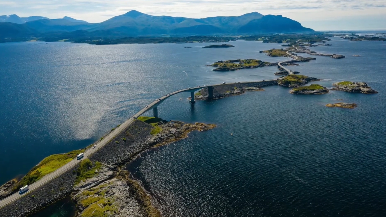
The Atlantic Road, or Atlanterhavsvegen, connects the island of Averøya with mainland Norway through a remarkable chain of bridges, causeways, and small islands.
The famous crossing covers approximately 8.3 kilometers (5.2 miles), although the officially designated Norwegian Scenic Route Atlanterhavsvegen extends 36 kilometers between Kårvåg and the fishing village of Bud.
Construction began in 1983, and the road opened on July 7, 1989.
The project faced difficult conditions. During its six-year construction period, workers encountered 12 storms described as reaching hurricane force.
That detail deserves more attention than it usually receives. Building across an exposed archipelago was an extraordinary undertaking, particularly when the Atlantic could interrupt work with violent weather.
Before the road opened, ferry connections were part of everyday transportation between Averøy and the mainland. The new crossing provided a permanent road connection.
For local residents, that was the important achievement.
Tourism changed the road’s reputation, but its original purpose explains why it exists in such an inhospitable location. It wasn’t built because someone thought a bridge surrounded by crashing waves would make an excellent photograph.
It was built because people needed to get across.
Alaska has an equally unusual solution to a local transport problem. The only road into Whittier passes through a one-lane tunnel shared with trains, so residents must follow a fixed timetable to enter or leave town.
The Atlantic Ocean Is the Real Wild Card
View this post on Instagram
The bridge’s optical illusion is entertaining. The surrounding sea is considerably more serious.
The Atlantic Road follows the exposed coast of Hustadvika, an area known for difficult maritime conditions. During powerful storms, waves can break against the islands, causeways, and road infrastructure.
Across the Atlantic, Cape Hatteras earned its nickname, the Graveyard of the Atlantic, after centuries of shipwrecks caused by dangerous shoals, powerful currents, and violent storms.
Photographs of enormous waves exploding beside passing vehicles have contributed to the route’s international reputation.
I understand the attraction. A little coastal drama makes an impressive picture, and the same stretch of road can look completely different under sunshine and storm clouds.
Still, I wouldn’t recommend deliberately driving into severe weather to experience it.
Wind, sea spray, reduced visibility, and dangerous road conditions are practical hazards, especially for drivers unfamiliar with the area.
The Norwegian Public Roads Administration provides current information through its official traffic service. Checking conditions before setting out is more useful than relying on somebody’s spectacular storm photograph.
There’s also something worth remembering about those images. A photograph compresses a moment into an exciting spectacle. The people using the road for ordinary journeys don’t have the luxury of treating bad weather as entertainment.
On a calm day, the surrounding landscape is impressive enough without anything crashing over the barriers.
The Best Way to Experience the Atlantic Road
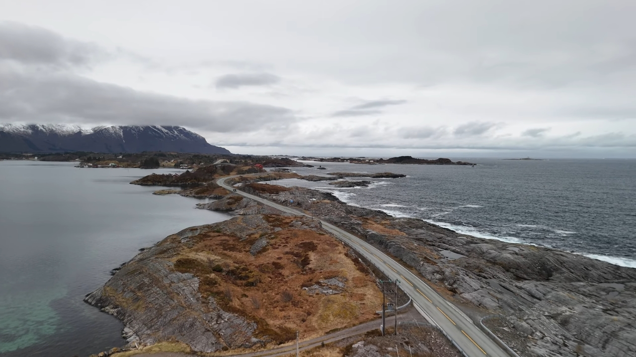
One mistake would be treating Storseisundet as a destination where you drive across, take a photograph, and immediately turn around.
The bridge is the headline attraction, certainly. Yet the entire coastline deserves attention.
The route moves between low rocky islands, sheltered stretches of water, and open views of the Atlantic. Mountains rise in the distance, and the surrounding settlements still have strong connections to fishing and maritime life.
For me, the interesting experience is watching how the road fits into the landscape, rather than racing toward the most recognizable photograph.
Two Stops Worth Making
The official scenic route includes designated rest areas that make it possible to appreciate the surroundings without creating a hazard for other drivers.
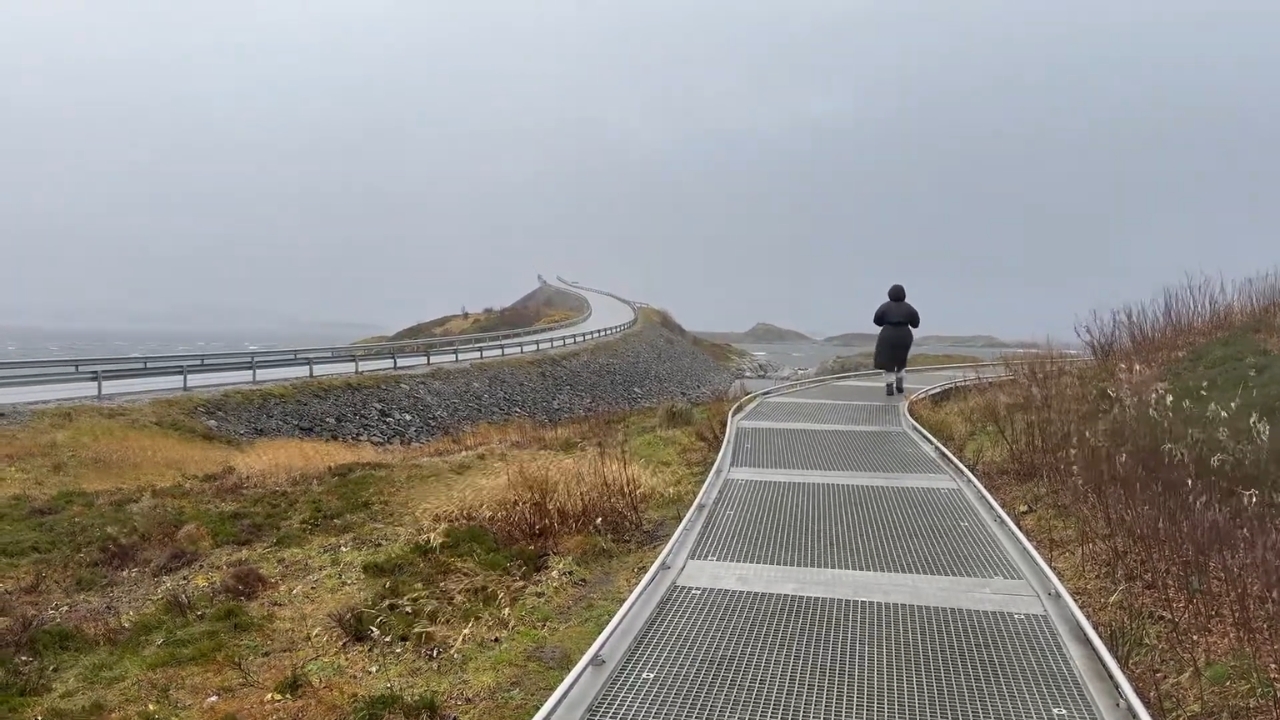
- Eldhusøya: An island with an elevated circular walking path offering views of the coast and surrounding bridges. The accessible walkway stays open year-round, and its café operates seasonally. I would make time for this stop even if the famous bridge weren’t nearby.
- Myrbærholmbrua: A bridge with specially constructed fishing walkways. Watching the tidal currents and understanding how fishing remains connected to the coastline adds something a roadside photograph cannot.
Both appear among the viewpoints maintained by Norwegian Scenic Routes.
If you’re planning the trip, allow at least an hour or two for the famous crossing and its stops, rather than the few minutes required to drive its entire length.
The full 36-kilometer scenic route deserves longer.
When Should You Visit?
Summer, particularly June through August, offers longer daylight hours and generally more comfortable conditions for exploring on foot.
The tradeoff is more visitors and traffic around popular viewpoints.
Spring and autumn can be rewarding if you’re comfortable with unsettled weather. Cloud cover can create wonderful coastal scenery, although rain and strong wind can make walking considerably less pleasant.
Winter has its own appeal, but shorter daylight hours and potentially severe driving conditions demand more careful planning.
My preference would be a flexible summer or early-autumn itinerary rather than a tightly scheduled detour. A spare hour allows you to wait for changing light, walk the viewpoints, or simply stop somewhere without watching the clock.
A few details are worth keeping in mind:
- Use a car for flexibility. Kristiansund and Molde are useful regional starting points. A car makes the scattered stops considerably easier to reach.
- Park only in designated areas. Never stop on the bridge or roadside to recreate a photograph.
- Don’t plan to camp at scenic parking areas. Overnight stays are not permitted at the designated Atlantic Road stopping places.
- Check conditions before departure. Weather and road restrictions can change, particularly outside summer.
The road itself is toll-free, so there’s no charge simply to drive across the bridges.
What the Famous Photograph Leaves Out
@fokkebokThe Atlantic Ocean Road 🏞Atlanterhavsveien in Norway is an 8.3 km stretch of County Road 64, weaving through a stunning archipelago in Møre og Romsdal. Known as one of the world’s most scenic drives, it features eight dramatic bridges, including the iconic Storseisundet Bridge, which curves like a rollercoaster over the wild Norwegian Sea. Built despite 12 hurricanes during construction and opened in 1989, it’s a marvel of engineering, connecting tiny islands from Kårvåg to Vevang. it’s a must-visit for road trip lovers!♬ Mariella – Khruangbin & Leon Bridges
The curious thing about the Atlantic Road is how thoroughly one photograph has come to represent an entire stretch of coastline.
It’s a phenomenon I’ve noticed in other destinations. The image becomes so recognizable that the place’s actual story gets pushed aside.
Something similar happened to the Austrian village of Hallstatt, whose appearance became so famous that developers eventually copied its historic center in China. The attractive picture traveled widely, but it couldn’t explain the history that produced the original village.
Norway’s Atlantic Road has a different story, although the lesson is familiar.
The strange bridge is memorable because of an unusual viewing angle. The remarkable part is that engineers managed to connect isolated coastal communities across an exposed stretch of ocean, creating infrastructure that now attracts travelers from around the world.
I think that distinction makes the place more interesting, not less.
There’s no need to exaggerate the danger or pretend the road actually plunges into the sea. Its real history is impressive enough.
And if you visit, give yourself time to see the bridge from the side, walk along the coast, and watch ordinary traffic passing over what the photographs make look impossible. The road doesn’t end at the top. The story doesn’t either.